


Air Quality During Wildfires: How to Stay Safe
Even if you are far enough away from a wildfire that you cannot see smoke or the fire itself, the air in your local area can still be unsafe. Understanding and measuring wildfire air quality goes beyond visible smoke. Smoke contains particulates that are too small to see, but this can be especially dangerous because they're small enough to enter your lungs.
In addition, the smoke from wildfires contains toxic substances that can have both immediate and long-term health effects, especially in those who are sensitive to smoke and have lung conditions that can cause breathing difficulties.
How Does Wildfire Smoke Affect the Air?
The smoke from fires can affect local air quality conditions for hundreds or even thousands of miles away. The most important thing to understand about wildfire smoke and air quality is that you do not have to see visible smoke for the air quality to be dangerous. Local media and weather stations can give you general information about trends affecting air quality from fires, but to keep you and your family safe, it is important to have information that is relevant to the immediate area surrounding your home.

This will allow you to plan and take action as needed. That is why knowing the AQI at your location with an AirLink air quality monitor should be an important part of your safety plan. If you live in wildfire territory, this is as essential as having a smoke detector and carbon monoxide detector in your home.
Can Wildfire Smoke Make You Sick?
It is important to monitor the air quality during wildfires because it can be harmful or dangerous even before you can see or smell the smoke. Smoke from western wildfires can drift as far as the East Coast, depending on weather conditions and the size of fires. Over the last two years, Canadian wildfires have caused significant air quality issues in the United States.
The smoke from a wildfire can travel, sink, rise, and linger miles distant from the actual flames. It can cause your nose to run, your eyes to burn, and exacerbate respiratory issues like asthma and bronchitis. Every breath you take of that air pulls microscopic particles deep into your lungs. We don't yet know enough about the health impacts of wildfire smoke, but it appears that widespread cardiopulmonary outcomes due to smoke are the most significant cause of death and illness from wildfires.
What can you do to protect yourself and your family against wildfire-caused air pollution? The CDC has a checklist of steps you can take to minimize harm from inhaling wildfire smoke.
How Do I Monitor the Air Quality During a Wildfire?
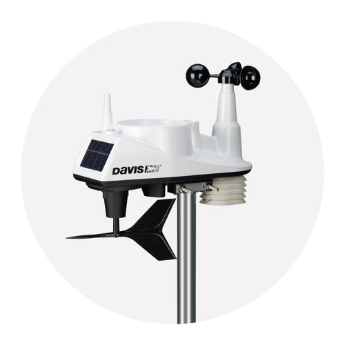
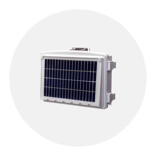
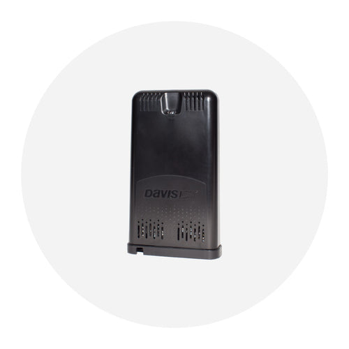
Many factors can affect wildfire air quality, such as local weather conditions, humidity, and the amount of fire control. Davis air quality monitors provide you with up-to-the-minute information on particulates from smoke in your area.
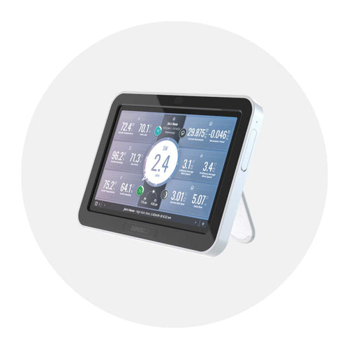
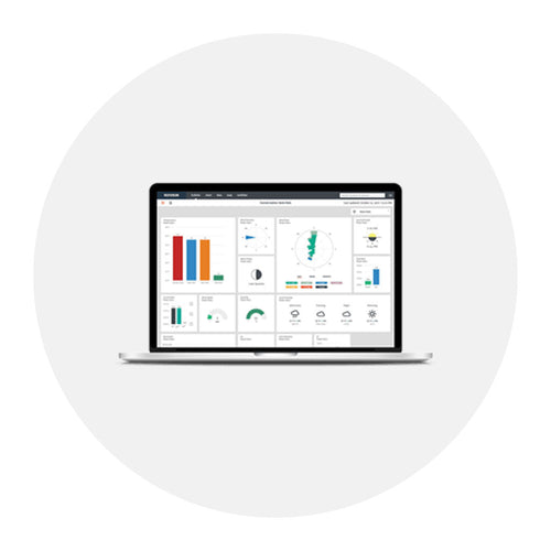
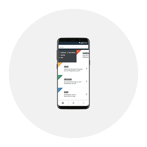
You can also view the data on your smartphone or PC using the WeatherLink app. It provides a handy graph that allows you to see whether particulate levels have gone up or down so that you can make plans. The data shows a scale that helps you determine whether the levels are mild, moderate, or pose a significant threat.
Know the Quality of the Air You Breathe
Outside

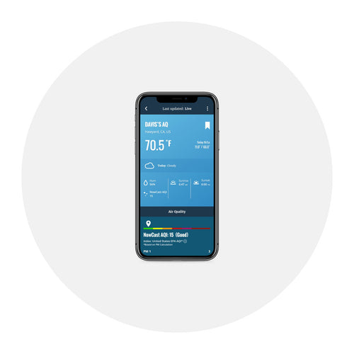
Top among their recommendations is to check local air quality reports. We’ll add on to that recommendation by suggesting that you check the air quality index (AQI) outside your home, rather than that measured some distance away. Microclimates, and therefore air quality, can vary substantially even over relatively short distances. With AirLink, you can know the AQI right where you live.
AirLink’s NowCast feature, which adjusts for quickly changing air quality, and wood smoke adjustment will give you a very accurate indication of what you are actually breathing, right now, right here.
Inside

When the AQI is high, you will want to stay indoors, especially if you have young or elderly family members or are in any susceptible group. The CDC also recommends that you keep the indoor air as clean as possible and avoid activities that increase indoor pollution. But how can you know? You can change the filter in your air intake, keep the windows closed, leave the gas range off, and the fireplace unlit. But the way to really know the effectiveness of these steps is to install a second AirLink inside your home. Now you can see clearly the difference between the air quality outside and inside. (We've made this option a little easier with our AirLink 2 pack.)
With AirLink, you will be able to access your own real-time, hyper-local AQI on your phone anytime. You will have the actual data at your fingertips to make decisions about when to shelter inside, when to turn on the air purifier, and whether that air purifier is effective.
Help Keep Your Community Safe
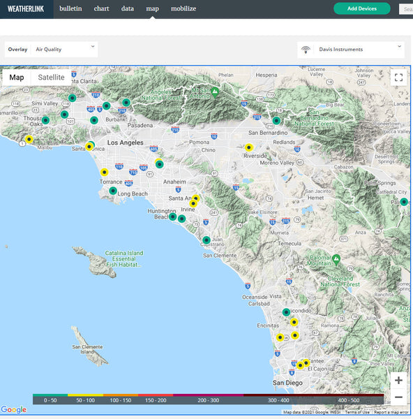
When you share your AQI on the WeatherLink Air Quality Map, you provide a valuable service to your neighbors, community leaders, and public health officials. Being able to see pockets of poor air quality, for example, can help your neighbor decide if, where, and when to go for a run. Seeing data from many monitors can help public health officials prepare for an increase in asthma attacks.
![]()
In the face of escalating environmental risks, AEM is the essential source for insights on weather, climate, lightning, floods, wildfires, water management, and more.
Learn more about AEM and all of our solutions here.