


Nautical charting, also known as boat charting or marine charting, refers to the process of using nautical charts to navigate and plan routes while boating or sailing.
Here are some key aspects of nautical charting:
Nautical Charts: Nautical charts are maps specifically created for marine navigation. They are typically produced by hydrographic offices or authorized agencies and are based on surveys and data collected by hydrographers. Nautical charts provide accurate and detailed representations of coastlines, water bodies, depths, navigation aids, and other important features.
Chart Reading: Nautical charting involves reading and interpreting nautical charts. This includes understanding symbols, abbreviations, and other charting conventions used to represent various navigational information. Key elements to consider include water depths, contours, channels, buoys, lighthouses, and potential hazards such as rocks, shoals, or wrecks.
Course Planning: Nautical charting helps in planning a safe and efficient course for a voyage or trip. By examining the nautical chart, mariners can identify channels, safe passages, and suitable anchorages. They can also assess potential hazards and plan for contingencies or alternative routes as needed.

Determining boat position, location, longitude, and latitude: Navigators use instruments, such as a GPS Global Positioning System or a marine sextant, to determine a boat's location. A sextant, such as the Davis Mark 25 or Mark 15, is an inexpensive, non-electronic instrument used for determining latitude and longitude, by measuring the angle between the horizon and a celestial body like the sun, moon, or a star. Sextants can be used as a primary navigational instrument or as a back-up to a GPS system in case of GPS failure.

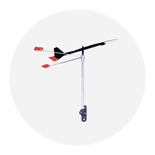
A simple compass can obtain quick magnetic bearings on shore or floating objects. The Davis Hand Bearing Compass is used for quick bearing or position set, checking distance offshore, establishing lee bow set while cruising, drift vectoring, and plotting a line of position.
Navigational Aids: Nautical charts provide information about navigational aids such as buoys, beacons, and lighthouses. These aids assist mariners in determining their position, maintaining the correct course, and avoiding hazards. Nautical charting involves utilizing this information to plot a course and make navigational decisions.

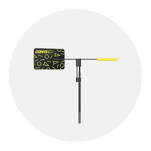
Boaters can refer to informational, at-a-glance aides such as the Davis Quick Reference Cards, which were designed in close cooperation with the U.S. Coast Guard Auxiliary and U.S. Power Squadrons. They are standard equipment on many U.S. Coast Guard and state boating administration patrol boats. Quick Reference Cards illustrate topics such as: Navigation Rules, Coastwise Piloting, International Navigation Rules, Weather Forecasting, Celestial Navigation, U.S. Buoyage System, right-of-way, lights, sound signals, and bridge signals.
Safety Considerations: Boat charting is crucial for ensuring safety on the water. By studying nautical charts, mariners can identify shallow areas, submerged obstacles, or areas prone to rough seas. This knowledge allows them to avoid potential dangers and navigate with caution.